
EXPLORE YOUR INNER HIKER
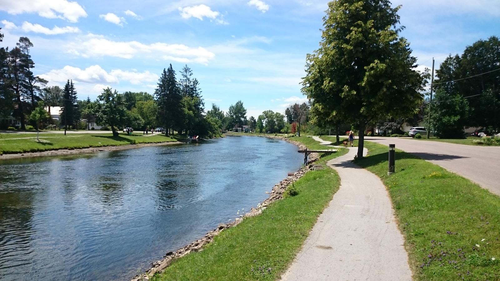
Explore on Foot
Welcome to the Hiking Trails of the Haliburton Highlands! Our trails take you through beautiful forests, peaceful lakes, and rocky hills. Whether you love hiking or are just trying it out, the Haliburton Highlands is a great place to explore nature.
Before you go, make sure to visit our What to Bring Hiking page to know what you need for a fun and safe hike.
Find Hiking Trails
EXPLORE WITH INSIDERS
Discover the Haliburton Highlands with our ‘Insiders Blog.’ Uncover hidden trails and secret spots with tips from locals who call this region home. Our expert insights ensure your hiking adventures in this Canadian paradise are extraordinary.
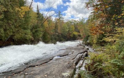
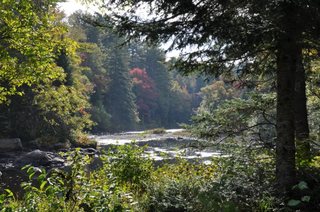
Buttermilk Falls
Buttermilk Falls By Rick Whitteker - Nature writer & outdoor guide Buttermilk Falls is a destination to step back in history without stepping indoors. The dramatic scenery of Buttermilk Falls has historically been popular picnic spot, attracting visitors because...
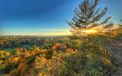
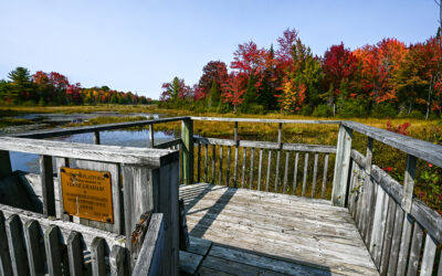
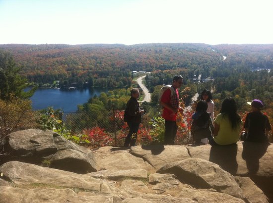
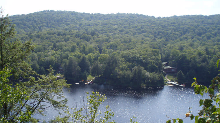
James Cooper Lookout
The James Cooper Lookout By Rick Whitteker - Nature writer & outdoor guide The James Cooper Lookout is a 1.5-kilometer loop that leads to a vantage point overlooking Maple, Beech, Boshkung and Twelve Mile Lakes. Whereas you can drive to higher lookouts, the effort...
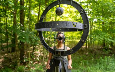
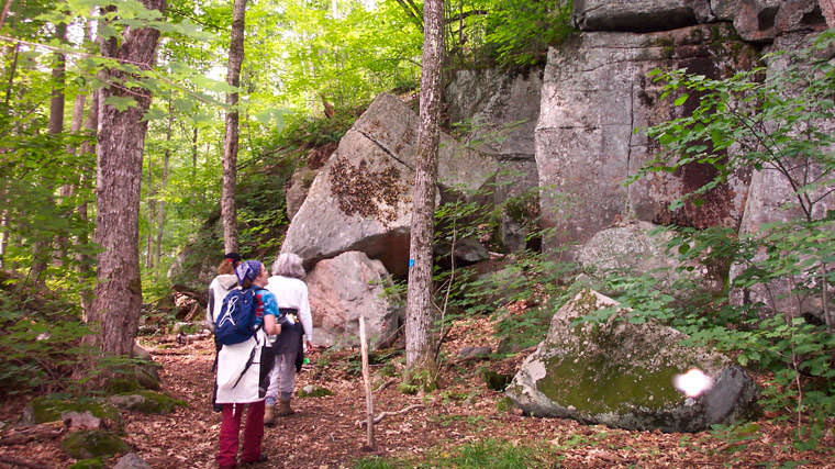
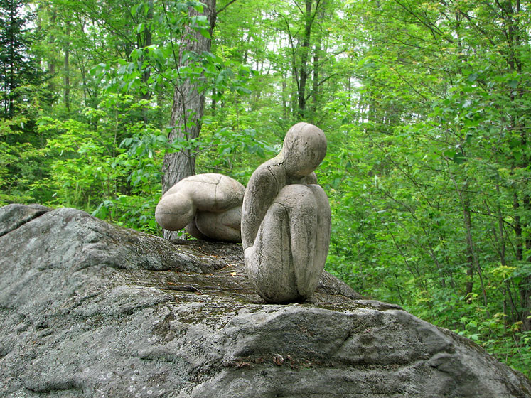
Sculpture Forest
Art in the Park Looking for a great year-round destination that is not weather dependent and shines in every season? You need to discover the Haliburton Sculpture Forest! Found in Glebe Park, just outside the Village of Haliburton and adjacent to the Haliburton School...
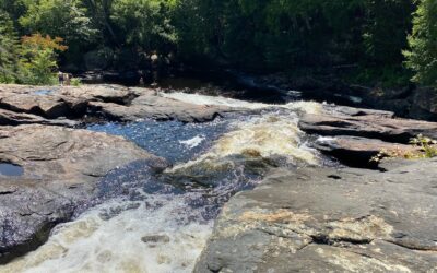
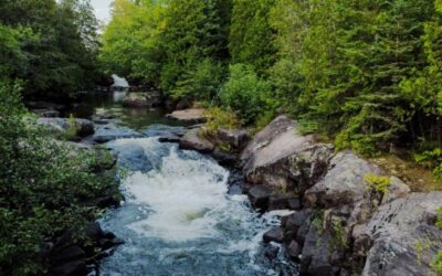
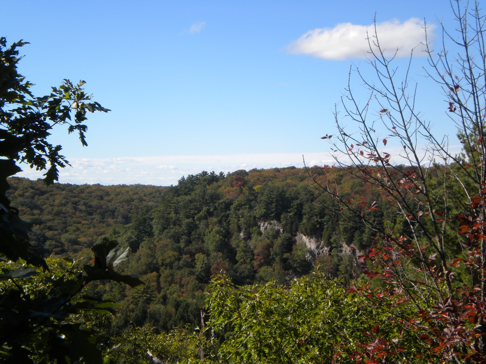
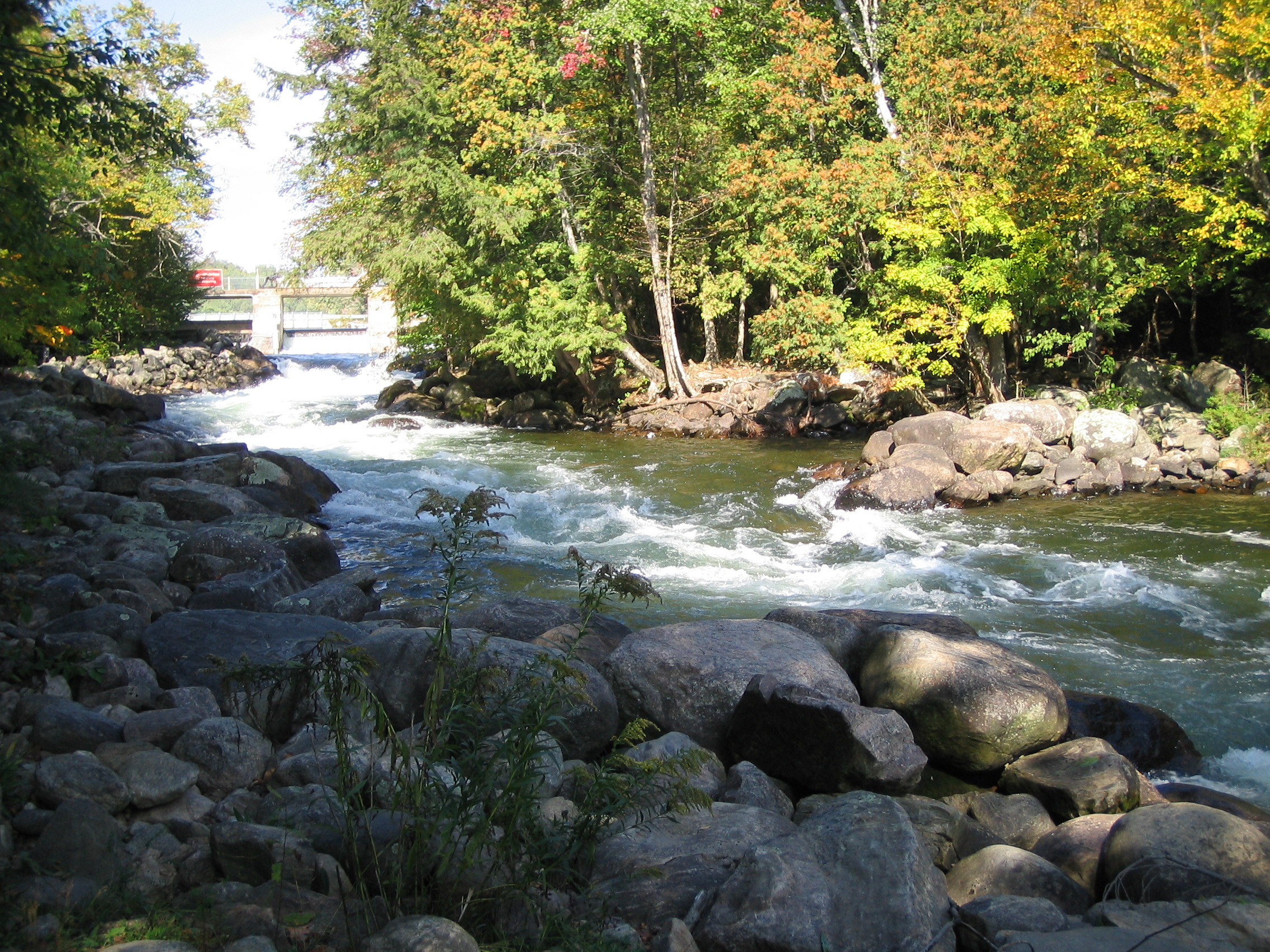
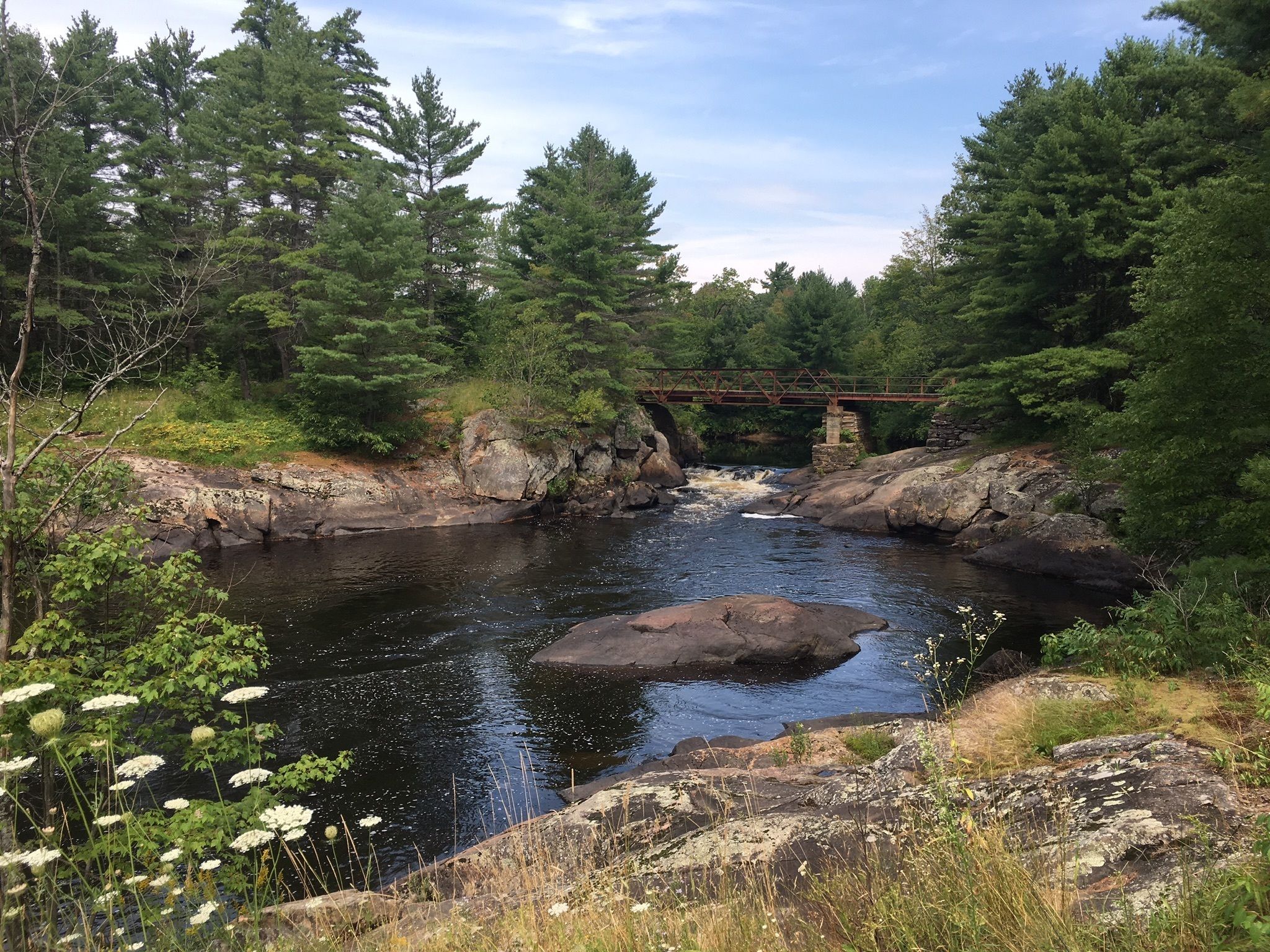
Adventure at High Falls
Pick your adventure at High Falls By Rick Whitteker - Nature writer & outdoor guide I like taking the road less travelled. During my international travel days, I enjoyed the adventure of avoiding the bolded attractions in the Let’s Go or Lonely Planet guides,...
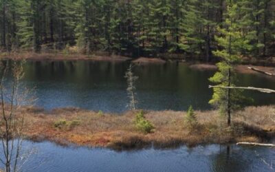
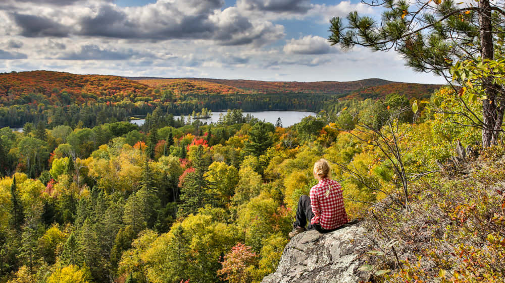
Savour Snowdon Park
Savour Snowdon Park's slow Adventure By Darren Lum - Adventurer. Biker. Freelancer. Former Dogsled guide, and long-time “newspaper guy.” Come for the lookouts, but stay for the discovery. Snowdon Park offers an approachable trail for beginner hikers and a...
Escape to Ritchie Falls
Escape to Ritchie Falls By Darren Lum - Adventurer. Biker. Freelancer. Former Dogsled guide, and long-time “newspaper guy.” Bask in everything Ritchie Falls can offer with a visit to tantalize the senses. It's where you can forget your troubles for however...
Fire Tower Trail – Loop with all the fixings
A loop trail with all the fixings By Rick Whitteker - Nature writer & outdoor guide If you are looking for a looped hiking trail in the Haliburton Highlands that checks off all the boxes, I have a suggestion. Moderate terrain, lakeside vistas, mature forest, well...

Abbey Gardens- Trails and more
Abbey Gardens- Trails and more! By Rick Whitteker - Nature writer & outdoor guide I like hiking. It is the best way I can find to move the body, exercise the heart, and calm the mind. At Abbey Gardens, everything is anchored in a philosophy of sustainability and...
Exploration Details – Hiking Trails
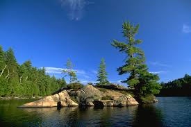
The County of Haliburton, AKA Haliburton Highlands, is comprised of four municipalities: Algonquin Highlands, Dysart et al, Highlands East, and Minden Hills. Each municipality offers unique and scenic hiking trails for all levels of adventurers.
The County itself operates one major trail, the Haliburton County Rail Trail, which provides a beautiful route through the region.
Haliburton County Rail Trail
The Rail Trail extends 35km from the village of Haliburton to the community of Kinmount.
The scenery along the way is exceptional, with lazy winding rivers, waterfalls, bogs, heritage bridges and even the ruins of a chemical plant.
Length: Approximately 35 km Difficulty: Easy to moderate
Features: Nature and Heritage
Access: Multiple access points throughout the length of the trail

Listed below, you’ll find detailed trail maps and information about the trails in each municipality, helping you plan your perfect outdoor adventure in the stunning Haliburton Highlands.
Algonquin Highlands
Dorset Scenic Tower Trail
This is a must-see for anyone wanting to truly experience the Highlands. This trail can also be hiked from the top of the ‘Dorset Mountain’ down to the museum. If you want to start at the top (option available May to October), a fee to drive up to the access point/picnic area is applicable. During the open season there’s also a gift shop/visitor information centre, washrooms and numerous photo opportunities at the top of Dorset Mountain.
Length: 1.5 km loop Difficulty: Challenging
Features: Dorset Lookout Tower
Access: From the bottom: 1038 Main Street, Dorset. From the top: 1154 Dorset Scenic Tower Road (off of Highway 35 North, just north of the Town of Dorset).
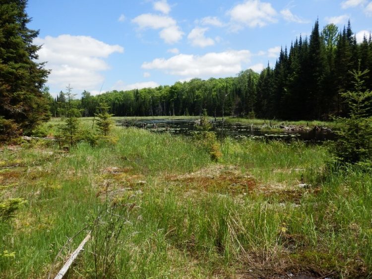
Beetle Lake Trail
These two lollipop loops hike through an active beaver pond, bog, hardwood hills and primary growth forest to a stunning lookout of Oxtongue Lake. Because of the varied and open forest types, this area provides one of the best opportunities in the Highlands for spotting many of Central Ontario’s best known bird and wildlife species such as Moose, Deer, Otter, Beaver, Snowshoe Hare, Red-tailed Hawk, Barred Owl and Ruffed Grouse, just to name a few!
Length: Currently consists of two 2.5 km ‘lollipop’ style out and back loops.
Difficulty: Challenging
Features: Close to Algonquin Park
Access: 1035 Algonquin Outfitters Road, Dwight – This road goes north off of Highway 60 just west of the Algonquin Park West Gate.
Ridge Trail Hiking Network
Length: Over 23.5 km combined – ranging from 0.7 km to 8 km
Difficulty: Easy Moderate Challenging
Features: Lookouts, heritage and nature at its best
Access: Multiple access points, please see map
Frost Centre Hiking Trails
Length: 1-11 km stacked loop
Difficulty: Easy
Features: Geomorphology Self-guided Hikes
Access: 20130 Highway 35 North – 12km south of the Town of Dorset.
Algonquin Park Trails
Widely considered to be one of the best provincial parks in Ontario, Algonquin Park features a multitude of hiking trails just waiting to be explored. The park features over a dozen interpretive walking trails, making your hike both challenging and fascinating.
Length: various
Difficulty: Easy moderate challenging
Features: Self-guided Hikes
Access: Highway 60 North – 37 km north of the Town of Dorset.
Dysart et al
Abbey Gardens
Hit the trails for some fun and exercise. At Abbey Gardens, they have about five km of marked trails that go through 140 acres of mature forest. This varied terrain is free to explore year-round, whenever you like.
Feel free to check in at the Food Hub during regular business hours.
Difficulty: Easy to moderate – 5 km
Features: Sample some beer from nano-brewery Haliburton Highlands Brewing, and learn about sustainable energy at Haliburton Solar and Wind’s demonstration sites.

Barnum Creek Nature Reserve
Barnum Creek Nature Reserve is a mosaic of habitats ranging from tolerant hardwood, mixed wood, early successional forests, and grassland, to marsh and swamp. Running through this tapestry of habitats is Barnum Creek
Barnum Creek has lovely trails and at times they can be very wet, muddy or icy. Wear appropriate footwear.
Difficulty: Heritage Hike easy to moderate – 5 km Waterfall Way – Easy to moderate – 3/4 km Ridge Trail – Challenging – 1 km
Features: Nature
Glebe Park & The Haliburton Sculpture Forest
On the north shore of Head Lake in the village of Haliburton, Glebe Park is 175 acres of woodlands and rolling hills with networks of trails for walking, mountain-biking, cross country-skiing and snowshoeing. It is also a great place to engage with art, culture and heritage. Glebe Park is home to the Haliburton Highlands Museum, Haliburton Sculpture Forest and Fleming College, Haliburton School of The Arts.
Difficulty: Easy to moderate
Features: Arts and Heritage
Access: Glebe Park has two entrances: 297 College Drive, Haliburton and/or 66 Museum Road, Haliburton
Head Lake & Drag River Trail
This community based trail travels around Head Lake exposing walkers to a variety of scenery around Haliburton.
Difficulty: Easy Moderate
Access: Anywhere in Haliburton Village
Haliburton Forest & Wild Life Reserve
The 300km of trails make Haliburton Forest an ideal destination for three season hiking vacations – you never have to explore the same trail twice. Guests staying overnight at Haliburton Forest have free access to trails. Day users must obtain a day pass or a season’s pass online or from the Main Office.
Length: over 300 km
Difficulty: Easy to Moderate
Features: Wolf Centre, Restaurant, Logging Museum & Canopy Tour
Access: 1095 Redkenn Road, Haliburton
High Falls Hiking Trail
From the end of the trail you have a view of the top of the rapids upstream of High Falls and a view downstream towards the falls. High Falls is part of Algonquin Park and permits are available online.
Length: 2 km
Difficulty: Easy Moderate
Access: You’ll find the trailhead 2 km beyond the Kingscote Lake Access Point Road intersection. Visit Deep Roots Adventure which is right across the trailhead for great information, and parking is available for a fee.

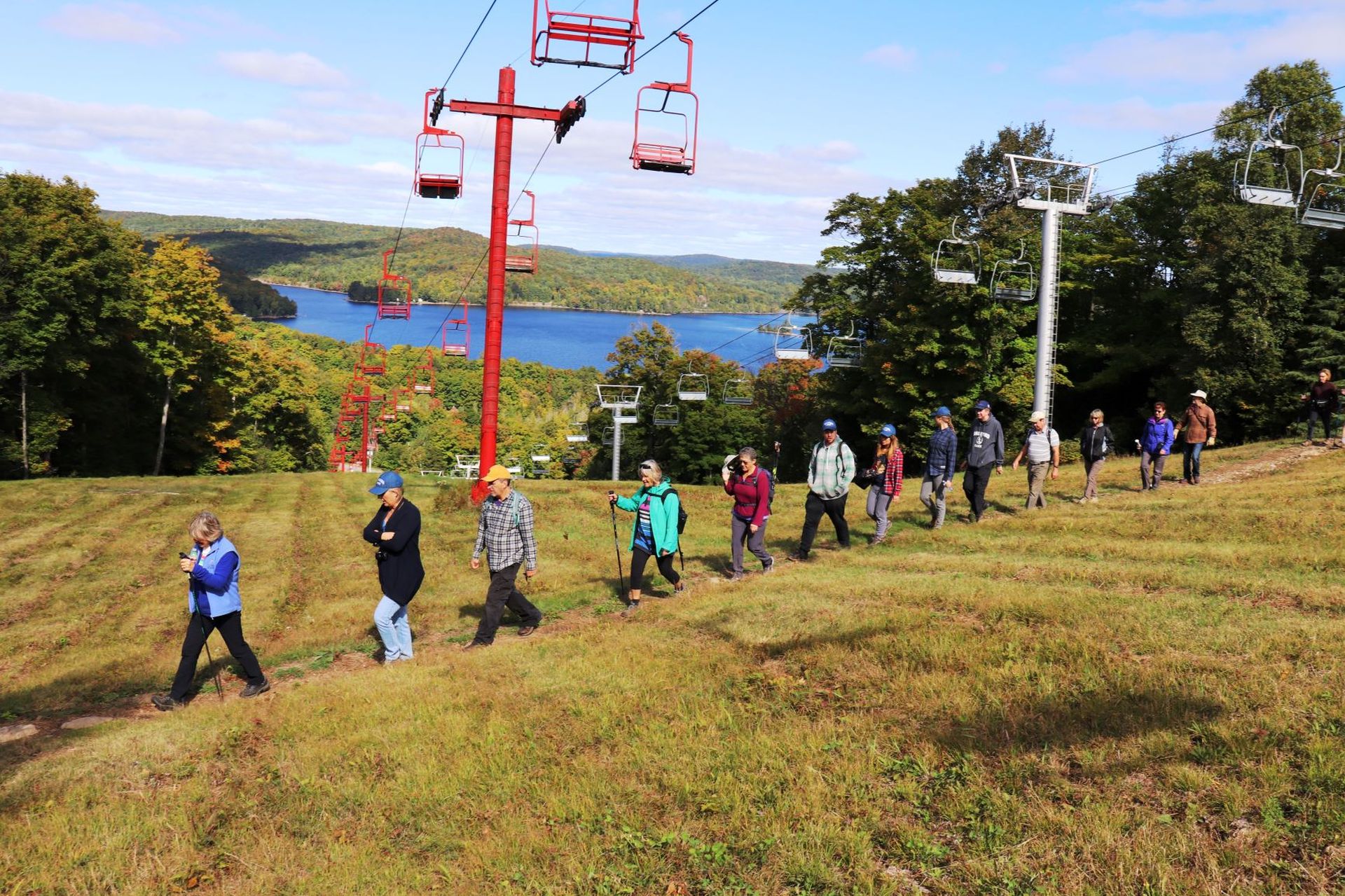
Sir Sam's Historical Interpretive Hiking Trail
Hike this scenic trail to the top of the hill to see remnants of what was once apple orchards and wheat fields while learning of the history of Sir Sam Hughes, Glenn Eagle Estate and the history and development of the ski hill. Cost is $5.00 per hiker at honour box & for more information
Length: 4+ km
Difficulty: Moderate
Features: Panaramic view over Eagle and Moose lakes
Access: 1054 Liswood Rd. Ealge Lake; access off parking lot at main chalet only
Highlands East
Farr Road Walking Trail
You may notice remnants of old pavement under foot. While this forgotten roadbed does eventually connect up with the existing highway just south of town your efforts to follow it through will be thwarted when the road abruptly disappears under a scenic wetland. Before turning back take a moment to admire the massive beaver dam that created the marsh and marvel at the engineering skills of this energetic family of beavers.
If you happen to be a geocacher, there are geocaches hidden along this trail.
Length: Approximately 600 m each way Difficulty: Easy

The Homesteader Trail Loop
The Homesteader Trail Loop is named in recognition of the pioneers who tried to farm this corner of the Canadian Shield. Today, roads and trails named after those Homesteaders are all that is left of the area’s farming past. Look for long abandoned overgrown farm fields and old stone fences.
Length: Approximately 25 km, can be divided into two smaller loops and offers great geocaching! Difficulty: Easy to moderate
Features: Geocaching Capital of Canada
Access: Trail heads located at Glamor Lake and Tory Hill Park

Prospector Trail
The Prospector Trail Loop is a trail with a tale of prospectors and miners who came in the 1920’s-1950’s for molybdenite and fluorite and discovered uraninite; the richest ore of radium. The route encompasses long abandoned mine sites such as the Harcourt Graphite mine, the Dwyer, Schickler, Tripp and Clark mines; long lost to the undergrowth. Take time to explore the rock cuts on the Old Burleigh Road and the I.B.&O. for black Tourmaline, blue Apatite and deep purple Flourite
Length: Approximately 18 km
Difficulty: Easy to moderate
Features: Red Cross Outpost, Mumford Road Mineral Collection Site and Geocaching
Access: Trail Head located in Wilberforce and Harcourt

Silent Lake Provincial Park
Silent Lake Provincial Park Loop Trail is a 13.8 kilometer moderately trafficked loop trail located near Highlands East, Ontario, Canada that features a lake and is rated as moderate. The trail is primarily used for hiking, walking, and nature trips and is best used from May until October. Dogs are also able to use this trail but must be kept on leash.
Length: Approximately 13.8 km
Difficulty: Easy to moderate
Sucker Lake Walking Trail
On occasion beaver dams, on ponds above Sucker Lake fail and gargantuan volumes of water pour into Sucker, overflowing and eventually washing away the dam. As you walk the trail you’ll see how those past spills have uprooted trees, bared the bedrock and carved a deep gully. On numerous occasions the flooding also undermined the railway track where the I.B.&O Railway crossed the creek at the mouth of the river. This spot became known to locals as “The Wash-Out” a favourite place for Sucker fishing in the spring.
Length: Approximately 750 m each way
Difficulty: moderate
Minden Hills
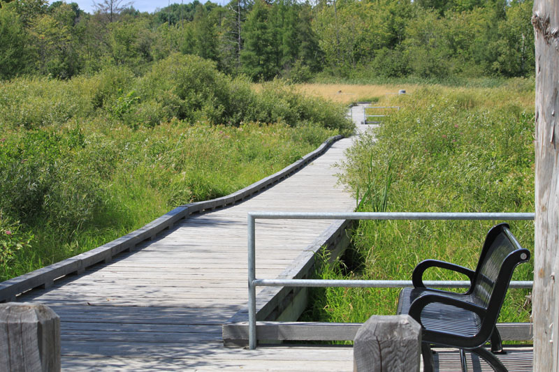
Minden Boardwalk
Main entrance and parking at the Minden Hills Cultural Centre, this boardwalk takes you through a natural grass marsh with the option of continuing to the Minden Ball Diamonds or on to intercept the Riverwalk, creating a lovely loop to include downtown Minden.
Length: Approximately 0.4km
Difficulty: Easy
Features: Fully accessible and permits bicycles
Access: Entrance is at the Cultural Centre on Bobcaygeon Road
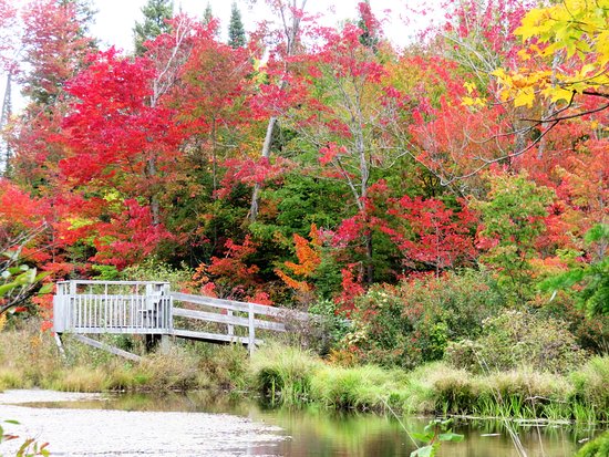
Minden Riverwalk
Length: Approximately 1km
Difficulty: Easy
Features: Accessible pathway and footbridge over the Gull River
Access: Along Water Street and Invergordon Avenue
Harrington Park & Minden Wild Water Preserve
Length: Approximately 0.5km
Difficulty: Easy to moderate
Features: Spectacular view of the rapids
Access: South of Horseshoe Lake Road / Bethel Road intersection
Killara Station
With over 215 acres of woods, pasture ,and miles of trails in beautiful Haliburton Highlands, we provide guided pack walk hikes every Wednesday Thursday Saturday Sunday at 2pm aprox 1 hour, dogs are $5 each humans are free honour box on the post. You can also book to walk your dogs on our trails at a time that is more convenient for you. Our private Dog park is also available for those of you that are not hikers but yours dogs are. For private time with your dogs or invite your friends for a play date, book on Sniffspot or call/text Paws at Killara Station. 705.854.0055
Length: 1.4km loops and a 5km loop
Difficulty: Easy to moderate

Snowdon Park
This is the largest park within our township, consisting of 460 acres of beautiful mixed woodland. This park is a must see destination point for outdoor enthusiasts for hiking, snowshoeing, cross country skiing, bird watching and many other outdoor activities.
Length: Approximately 3km with several other shorter trails throughout
Difficulty: Easy to moderate
Features: Year round access and wheelchair accessible sections
Access: Entrance is just south of the South Lake/Gelert Roads intersection
Madison Twin Lake Resort
Length: The trail consists of two loops – 2 km and 3 km
Difficulty: Moderate
Features: Accessible for Hiking during the Spring, Summer and Fall seasons.
Access: Off Hwy 35, 9 km north of Minden, west on Taylor Rd. or Twelve Mile Lake Road for a minute or two. Small parking lot and gate on west side of road.
Dahl Forest
Haliburton Highlands Land Trust’s Dahl Forest is approximately 500 acres and straddles 2.7 km of the Burnt River in Haliburton County 5 km south of Gelert. The ecological significance of the Dahl Forest is evident in the diversity of species and habitats found on the property.
Difficulty: Easy to moderate
Features: Nature and conservation planning
Access: 1307 Geeza Rd, off of Gelert Rd/County Rd 1 just 5 km south of Gelert.
Ganaraska Hiking Trail - Wilderness Section
As well as being scenic, it is rugged and challenging. It is strongly recommended that the Wilderness Section only be hiked with an experienced hiker familiar with the Trail. For more information see the Wilderness section Facebook page at https://www.facebook.com/GHTAwilderness/
Difficulty: Moderate to challenging
Features:
Access: Reminder re parking at Moore Falls. Please park in open grassy area to left of trail off Country Rd. just west of Hwy 35. No parking at km 1.1, where the trail leaves Black Lake Cottage Rd. to enter the woods. And definitely no parking at the Black Lake Cottage Rd. parking area.
Haliburton Highlands Trekkers
Local club of active snowshoers, paddlers and hikers… Learn More
Ganaraska Hiking Trail Association
Wilderness Club – Learn More
Stay up to date
Sign-up for our Newsletter and we’ll keep you updated on events and ideas for planning your next trip in the Haliburton Highlands!